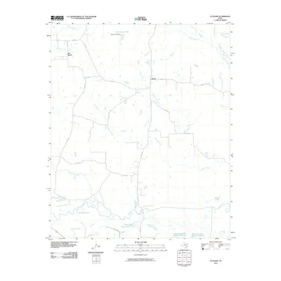
2010 Map of Cuthand
USGS Topo · Published 2010About this map
Sulphur River meanders across the southern portion of this landscape, defining a complex system of oxbows and wetlands including Horseshoe Lake and Timber Lake. This 2010 survey shows the agricultural character of Red River County, where small rural communities like Cuthand and Pine Branch serve as focal points for a network of farm-to-market roads and county routes. The drainage patterns are a primary feature, with Whiteoak Creek, Ringo Creek, and the namesake Cuthand Creek carving through the countryside toward the river bottomlands.
Find a feature on this map
33 named features on this map. Tap any name to fly to it.
Don’t see what you’re looking for? This feature index may not catch every label — zoom into the map to look around manually.
Map Details
Editions of this 2010 Cuthand Map
This is the sole edition of this map. No revisions or reprints were ever made.
Other maps of this area

1950 · Annona
USGS Topo · 1:24,000

1951 · Annona
USGS Topo · 1:24,000

1953 · Texarkana
USGS Topo · 1:250,000

1956 · Texarkana
USGS Topo · 1:250,000

1964 · Cuthand
USGS Topo · 1:24,000

1964 · Wilkinson
USGS Topo · 1:24,000

1964 · Talco
USGS Topo · 1:24,000

1964 · Hagansport
USGS Topo · 1:24,000

1964 · Bogata
USGS Topo · 1:24,000
1964 · Line Branch
USGS Topo · 1:24,000