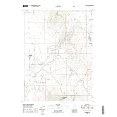
2020 Map of Cutler Dam
USGS Topo · Published 2020About this map
Cutler Dam stands at the center of this landscape where the Bear River cuts through the Junction Hills, marking a critical point of water management and geography at the border of Box Elder and Cache counties. The surrounding terrain transitions from the low Bear River Valley to the heights of the Wellsville Mountains within the Wasatch Range. The map reveals an intricate network of irrigation, including the West Side Canal and West Canal, which support the agricultural settlements of Fielding, Newton, and Collinston. Local history is preserved in the naming of rural sites like Wheelon and several family-linked burial grounds. Genealogists will find particular value in the locations of the Poulsen Family Cem, Beaver Dam Cem, and East Garland Cem, which anchor the early families of this river corridor.
Find a feature on this map
75 named features on this map. Tap any name to fly to it.
Don’t see what you’re looking for? This feature index may not catch every label — zoom into the map to look around manually.
Map Details
Editions of this 2020 Cutler Dam Map
This is the sole edition of this map. No revisions or reprints were ever made.
Other maps of this area

1914 · Logan
USGS Topo · 1:125,000

1916 · Logan
USGS Topo · 1:125,000

1954 · Ogden
USGS Topo · 1:250,000

1954 · Brigham City
USGS Topo · 1:250,000

1958 · Ogden
USGS Topo · 1:250,000

1958 · Brigham City
USGS Topo · 1:250,000

1960 · Ogden
USGS Topo · 1:250,000

1961 · Honeyville
USGS Topo · 1:24,000

1961 · Tremonton
USGS Topo · 1:24,000

1962 · Brigham City
USGS Topo · 1:250,000