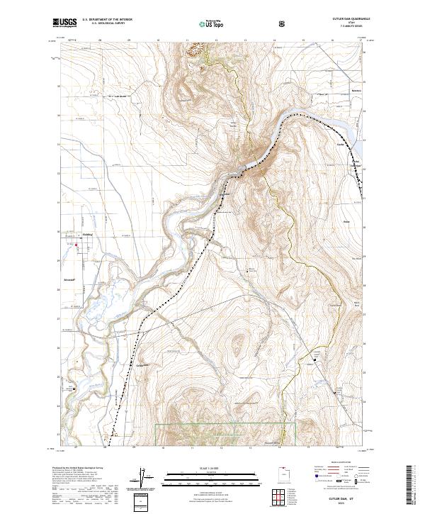
2023 Map of Cutler Dam
USGS Topo · Published 2023About this map
The Bear River winds through the heart of this Box Elder and Cache County landscape, defining the industrial and agricultural character of the Bear River Valley. A complex network of irrigation infrastructure, including the West Side Canal, Hammond Main Canal, and Corinne Canal, illustrates the intensive water management required for farming between the Junction Hills and the Wellsville Mountains. The topography is marked by the Long Divide and the prominent Cache Butte, which overlook a series of small settlements and transportation hubs.
Find a feature on this map
82 named features on this map. Tap any name to fly to it.
Don’t see what you’re looking for? This feature index may not catch every label — zoom into the map to look around manually.
Map Details
Editions of this 2023 Cutler Dam Map
This is the sole edition of this map. No revisions or reprints were ever made.
Other maps of this area

1914 · Logan
USGS Topo · 1:125,000

1916 · Logan
USGS Topo · 1:125,000

1954 · Ogden
USGS Topo · 1:250,000

1954 · Brigham City
USGS Topo · 1:250,000

1958 · Ogden
USGS Topo · 1:250,000

1958 · Brigham City
USGS Topo · 1:250,000

1960 · Ogden
USGS Topo · 1:250,000

1961 · Honeyville
USGS Topo · 1:24,000

1961 · Tremonton
USGS Topo · 1:24,000

1962 · Brigham City
USGS Topo · 1:250,000