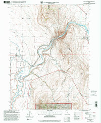
1998 Map of Cutler Dam
USGS Topo · Published 2001About this map
Bear River dominates this northern Utah landscape, winding through a complex topography where the Junction Hills and Long Divide meet. By the late 1990s, the river’s power was fully harnessed by the Cutler Reservoir and multiple irrigation systems, including the West Corinne Canal and Hammond Canal. These waterways supported the established settlements of Fielding and Collinston, while a Powerhouse and Gaging Station near the dam reflect the area's hydroelectric development.
Find a feature on this map
31 named features on this map. Tap any name to fly to it.
Don’t see what you’re looking for? This feature index may not catch every label — zoom into the map to look around manually.
Map Details
Editions of this 1998 Cutler Dam Map
This is the sole edition of this map. No revisions or reprints were ever made.
Other maps of this area

1914 · Logan
USGS Topo · 1:125,000

1916 · Logan
USGS Topo · 1:125,000

1954 · Ogden
USGS Topo · 1:250,000

1954 · Brigham City
USGS Topo · 1:250,000

1958 · Ogden
USGS Topo · 1:250,000

1958 · Brigham City
USGS Topo · 1:250,000

1960 · Ogden
USGS Topo · 1:250,000

1961 · Honeyville
USGS Topo · 1:24,000

1961 · Tremonton
USGS Topo · 1:24,000

1962 · Brigham City
USGS Topo · 1:250,000