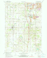
1967 Map of Cutlerville
USGS Topo · Published 1991About this map
Buck Creek and the Penn Central railroad corridor anchor this mid-century view of the developing suburban fringe south of Grand Rapids. The landscape reveals a transition from the dense residential grids of Wyoming and Kentwood in the north to the sprawling institutional presence of the Pine Rest Hospital Complex and the industrial activity of numerous Gravel Pits. Local history is preserved in the placement of several family and community burial grounds, such as Boynton Cem and Winchester Cem, alongside a network of country schools including Emmons Sch and Marshall Sch. Moving south, the terrain opens into a more rural pattern near Byron Center and the village of Corinth, where small water bodies like Hilton Lake and Ross Lake punctuate the landscape of the Kent and Allegan county line.
Find a feature on this map
76 named features on this map. Tap any name to fly to it.
Don’t see what you’re looking for? This feature index may not catch every label — zoom into the map to look around manually.
Map Details
Editions of this 1967 Cutlerville Map
Other maps of this area

1914 · Grand Rapids
USGS Topo · 1:62,500

1943 · Grand Rapids
USGS Topo · 1:62,500

1958 · Allegan
USGS Topo · 1:62,500

1958 · Grandville
USGS Topo · 1:62,500

1958 · Grandville
USGS Topo · 1:24,000

1958 · Grand Rapids
USGS Topo · 1:250,000

1959 · Wayland
USGS Topo · 1:62,500

1961 · Grand Rapids
USGS Topo · 1:250,000

1962 · Grand Rapids
USGS Topo · 1:250,000
1967 · Grand Rapids West
USGS Topo · 1:24,000