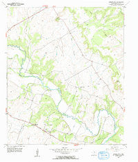
1956 Map of Cutoff Mtn
USGS Topo · Published 1957About this map
Cutoff Mountain rises above a rural landscape defined by the winding course of the Leon River in this mid-1950s survey of Hamilton County. The settlement at Whiteway and the surrounding countryside reflect a deeply established community, evidenced by numerous small cemeteries such as Viertel Cem and Bullman Cem. The social fabric of the era is anchored by rural institutions like Pleasant Valley Ch and the Evergreen Sch (Aband), the latter already noted as abandoned by the time of the field check.
Find a feature on this map
22 named features on this map. Tap any name to fly to it.
Don’t see what you’re looking for? This feature index may not catch every label — zoom into the map to look around manually.
Map Details
Editions of this 1956 Cutoff Mtn Map
2 editions found
Other maps of this area

1888 · Hamilton
USGS Topo · 1:125,000

1888 · Meridian
USGS Topo · 1:125,000

1894 · Hamilton
USGS Topo · 1:125,000

1894 · Meridian
USGS Topo · 1:125,000

1954 · Brownwood
USGS Topo · 1:250,000

1954 · Waco
USGS Topo · 1:250,000

1955 · Waco
USGS Topo · 1:250,000
1955 · Ater
USGS Topo · 1:24,000
1956 · Jonesboro
USGS Topo · 1:24,000

1956 · Cranfills Gap
USGS Topo · 1:24,000