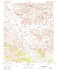
1943 Map of Cuyama Peak
USGS Topo · Published 1982About this map
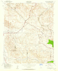
The Cuyama Valley landscape documented here during the early 1940s reveals a sparse network of ranching outposts along the wide, braided path of the Cuyama River. The settlement of Ventucopa serves as a central point in this arid corridor, flanked by established homesteads including the Wycoff Ranch and Le Vezu Ranch. The terrain is defined by the sharp transition from the valley floor to the high elevations of the Los Padres National Forest, where drainage systems like Quatal Canyon and Ballinger Canyon carve deep into the surrounding heights. Genealogists and local historians can trace the early 20th-century footprint of the region through family-named landmarks such as Monreal Ranch and Ogan Ranch, while the presence of the Cuyama Ranger Sta and a Lookout Tower near the summit of Cuyama Peak highlights the importance of fire surveillance in these remote coastal mountains.
Find a feature on this map
21 named features on this map. Tap any name to fly to it.
Don’t see what you’re looking for? This feature index may not catch every label — zoom into the map to look around manually.
Map Details
Editions of this 1943 Cuyama Peak Map
5 editions found
Other maps of this area

1902 · Santa Ynez
USGS Topo · 1:125,000

1903 · Mt. Pinos
USGS Topo · 1:125,000

1905 · Santa Ynez
USGS Topo · 1:125,000

1942 · Ballinger Canyon
USGS Topo · 1:24,000

1942 · East of Cuyama Ranch
USGS Topo · 1:24,000

1943 · Rancho Nuevo Creek
USGS Topo · 1:24,000

1943 · Apache Canyon
USGS Topo · 1:24,000

1943 · Santiago Creek
USGS Topo · 1:24,000
1943 · Ballinger Canyon
USGS Topo · 1:24,000

1943 · Cuyama Peak
USGS Topo · 1:24,000