
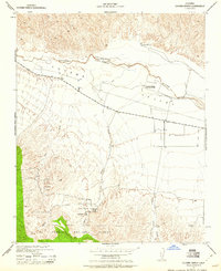
1943 Map of Cuyama Ranch
USGS Topo · Published 1943About this map
The Cuyama Valley landscape in 1943 is defined by the winding course of the Cuyama River, which serves as a natural boundary between San Luis Obispo and Santa Barbara counties. This War Department survey captures a mid-century agricultural corridor where the Cuyama Ranch and Cuyama Ranch Headquarters anchor the local economy alongside the Johnson Ranch to the south. To the southwest, the terrain rises into the Los Padres National Forest, where the Branch Canyon Guard Station monitors the drainage systems of Branch Canyon and Newsome Canyon. The layout of State Route 166 provides a clear view of the transportation network connecting these remote ranching outposts before later developments altered the valley's character. Local historians can trace the early water management through various ditches and the complex network of canyons including Salisbury Canyon and Bitter Creek.
Find a feature on this map
13 named features on this map. Tap any name to fly to it.
Don’t see what you’re looking for? This feature index may not catch every label — zoom into the map to look around manually.
Map Details
Editions of this 1943 Cuyama Ranch Map
2 editions found
Other maps of this area

1902 · Santa Ynez
USGS Topo · 1:125,000

1905 · Santa Ynez
USGS Topo · 1:125,000

1912 · McKittrick
USGS Topo · 1:125,000

1941 · Caliente Mountain
USGS Topo · 1:62,500

1941 · McPherson Peak
USGS Topo · 1:62,500

1942 · Caliente Mtn
USGS Topo · 1:62,500

1942 · East of Cuyama Ranch
USGS Topo · 1:24,000

1943 · McPherson Peak
USGS Topo · 1:62,500

1943 · Caliente Mtn.
USGS Topo · 1:62,500
1943 · Fox Mountain
USGS Topo · 1:24,000