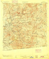
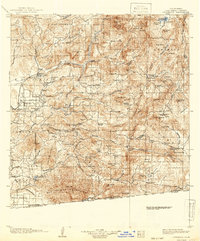
1903 Map of Cuyamaca
USGS Topo · Published 1909About this map
The San Diego Cuyamaca and Eastern R.R. anchors the western edge of this landscape, reflecting the rail-driven growth of the region at the start of the 20th century. This survey details a complex geography of Spanish-named land grants and ranchos, including Jamul, Jamacha, and Otay (Estudillo), which illustrate the transition from Mexican era landholdings to American administration. The terrain rises sharply from the coastal plains toward the interior highlands, marked by the prominent peaks of the Cuyamaca Pk. range and the Capitan Grande Indian Reservation. Water management for the growing population is evident through features like the Cuyamaca Reservoir and early masonry structures at Barrett Dam and Morena Dam. Scattered settlements such as Bostonia, Alpine, and Dulzura are shown alongside smaller outposts like Honey Springs Ranch, providing a window into early San Diego County's rural backcountry before the mid-century suburban expansion.
Find a feature on this map
116 named features on this map. Tap any name to fly to it.
Don’t see what you’re looking for? This feature index may not catch every label — zoom into the map to look around manually.
Map Details
Editions of this 1903 Cuyamaca Map
6 editions found
Other maps of this area

1893 · El Cajon
USGS Topo · 1:62,500

1893 · Escondido
USGS Topo · 1:62,500

1901 · Elcajon
USGS Topo · 1:62,500

1901 · Escondido
USGS Topo · 1:62,500

1901 · San Luis Rey
USGS Topo · 1:125,000

1903 · Cuyamaca
USGS Topo · 1:125,000

1903 · La Jolla
USGS Topo · 1:62,500

1903 · Elcajon
USGS Topo · 1:62,500

1903 · Ramona
USGS Topo · 1:125,000

1904 · San Diego
USGS Topo · 1:62,500