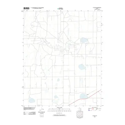
2010 Map of Cuyler
USGS Topo · Published 2010About this map
Cuyler stands as the primary namesake settlement in this high plains landscape of Carson County, Texas. The terrain is defined by its wide, open drainage patterns, specifically the headwaters of East Dixon Creek in the northwest and West Fork Bear Creek to the east. By the early 21st century, the area maintained its rural character, organized by a rigid grid of local routes like Co RD Q, Co RD 17, and Co RD 15. The agricultural and ranching infrastructure is further connected by FM 2385, which serves as a major north-south corridor through the quadrangle. Small playas and seasonal water bodies are scattered throughout the sections, illustrating the semi-arid hydrology of the Texas Panhandle.
Find a feature on this map
15 named features on this map. Tap any name to fly to it.
Don’t see what you’re looking for? This feature index may not catch every label — zoom into the map to look around manually.
Map Details
Editions of this 2010 Cuyler Map
This is the sole edition of this map. No revisions or reprints were ever made.
Other maps of this area

1953 · Borger SE
USGS Topo · 1:24,000

1953 · McBride
USGS Topo · 1:24,000

1954 · Amarillo
USGS Topo · 1:250,000

1958 · Amarillo
USGS Topo · 1:250,000

1963 · Skellytown
USGS Topo · 1:24,000

1965 · White Deer
USGS Topo · 1:24,000

1965 · Abell
USGS Topo · 1:24,000

1966 · Panhandle West
USGS Topo · 1:24,000

1966 · Panhandle East
USGS Topo · 1:24,000

1966 · Cuyler
USGS Topo · 1:24,000