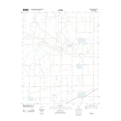
2012 Map of Cuyler
USGS Topo · Published 2012About this map
The settlement of Cuyler anchors the southeast corner of this Texas Panhandle landscape, where the agricultural character of Carson County is mapped in detail. A network of rural county roads, including Co Rd R and Co Rd 17, creates a distinct grid across the terrain, interrupted only by the seasonal drainage of E Dixon Cr and W Fork Bear Cr. The presence of the Carson County Feedyard signifies the region's long-standing cattle industry, a primary economic driver in this part of the High Plains. While the map is sparse in dense settlements, the placement of numerous stock tanks and the alignment of Ranch Road 2385 reflect the practical needs of large-scale ranching and land management in the early 21st century.
Find a feature on this map
18 named features on this map. Tap any name to fly to it.
Don’t see what you’re looking for? This feature index may not catch every label — zoom into the map to look around manually.
Map Details
Editions of this 2012 Cuyler Map
This is the sole edition of this map. No revisions or reprints were ever made.
Other maps of this area

1953 · Borger SE
USGS Topo · 1:24,000

1953 · McBride
USGS Topo · 1:24,000

1954 · Amarillo
USGS Topo · 1:250,000

1958 · Amarillo
USGS Topo · 1:250,000

1963 · Skellytown
USGS Topo · 1:24,000

1965 · White Deer
USGS Topo · 1:24,000

1965 · Abell
USGS Topo · 1:24,000

1966 · Panhandle West
USGS Topo · 1:24,000

1966 · Panhandle East
USGS Topo · 1:24,000

1966 · Cuyler
USGS Topo · 1:24,000