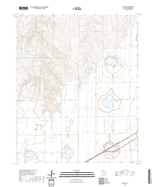
2022 Map of Cuyler
USGS Topo · Published 2022About this map
The settlement of Cuyler serves as a central point in this Carson County landscape, where the flat Texas plains begin to break into the drainage systems of the Panhandle. Seasonal watercourses define the northern topography, notably the winding paths of East Dixon Creek and its tributary E Dixon Cr, alongside the W Fork Bear Cr to the northeast. These drainages create a distinct contrast with the organized grid of the surrounding agricultural lands. The map details a network of rural infrastructure, including FM 2385 and numerous county roads such as Sealy and Co RD T. This area illustrates the persistence of small rail-side communities and the essential water management patterns required for ranching and farming in the high plains region.
Find a feature on this map
20 named features on this map. Tap any name to fly to it.
Don’t see what you’re looking for? This feature index may not catch every label — zoom into the map to look around manually.
Map Details
Editions of this 2022 Cuyler Map
This is the sole edition of this map. No revisions or reprints were ever made.
Other maps of this area

1953 · Borger SE
USGS Topo · 1:24,000

1953 · McBride
USGS Topo · 1:24,000

1954 · Amarillo
USGS Topo · 1:250,000

1958 · Amarillo
USGS Topo · 1:250,000

1963 · Skellytown
USGS Topo · 1:24,000

1965 · White Deer
USGS Topo · 1:24,000

1965 · Abell
USGS Topo · 1:24,000

1966 · Panhandle West
USGS Topo · 1:24,000

1966 · Panhandle East
USGS Topo · 1:24,000

1966 · Cuyler
USGS Topo · 1:24,000