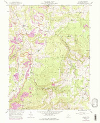
1959 Map of Cuzzart
USGS Topo · Published 1998About this map
The Pleasant Mountains and Briery Mountain define the high-elevation landscape of this Preston County region during the late 1950s. Settlement is concentrated along the historic Brandonville Turnpike and Brandonville Road, connecting the village of Cuzzart to outlying hamlets like Orr and Afton. The map reveals a robust network of community institutions typical of rural West Virginia, including the Mountain Dale Ch, Lenox Ch, and numerous educational sites like Center Sch and Laurel Glen Sch.
Find a feature on this map
43 named features on this map. Tap any name to fly to it.
Don’t see what you’re looking for? This feature index may not catch every label — zoom into the map to look around manually.
Map Details
Editions of this 1959 Cuzzart Map
4 editions found
Other maps of this area

1886 · St. George
USGS Topo · 1:125,000

1891 · St. George
USGS Topo · 1:125,000

1895 · Piedmont
USGS Topo · 1:125,000

1899 · Oakland
USGS Topo · 1:62,500

1900 · Accident
USGS Topo · 1:62,500

1900 · Oakland
USGS Topo · 1:62,500

1904 · Bruceton
USGS Topo · 1:62,500

1907 · Kingwood
USGS Topo · 1:62,500

1925 · Kingwood
USGS Topo · 1:62,500

1926 · Bruceton
USGS Topo · 1:62,500