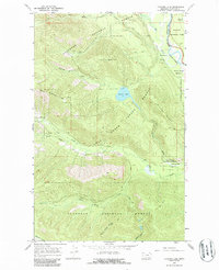
1966 Map of Cyclone Lake
USGS Topo · Published 1986About this map
Glacier National Park and the Flathead National Forest meet at the Flathead River (North Fork), defining a landscape of high ridges and deep watercourses. This mid-1960s survey documents the primitive infrastructure of the Montana wilderness, anchored by Home Ranch Bottoms and a network of Pack Trails that provided the only access to much of the interior. A prominent Lookout Tower sits atop Cyclone Peak, overlooking the basin of Cyclone Lake. The presence of these vantage points and trails suggests the critical role of fire watch and forest management in this era. To the south and west, the terrain is carved by the Coal Creek drainage system, including the South Fork Coal Creek and Dead Horse Creek, which run through heavy timber beneath Winona Ridge and Coal Ridge.
Find a feature on this map
26 named features on this map. Tap any name to fly to it.
Don’t see what you’re looking for? This feature index may not catch every label — zoom into the map to look around manually.
Map Details
Editions of this 1966 Cyclone Lake Map
2 editions found
Other maps of this area

1906 · Kintla Lakes
USGS Topo · 1:125,000

1938 · Kintla Lakes
USGS Topo · 1:125,000

1957 · Kalispell
USGS Topo · 1:250,000

1960 · Kalispell
USGS Topo · 1:250,000

1961 · Kalispell
USGS Topo · 1:250,000
1966 · Demers Ridge
USGS Topo · 1:24,000
1966 · Huckleberry Mountain
USGS Topo · 1:24,000
1966 · Skookoleel Creek
USGS Topo · 1:24,000
1966 · Moose Peak
USGS Topo · 1:24,000
1966 · Whale Buttes
USGS Topo · 1:24,000