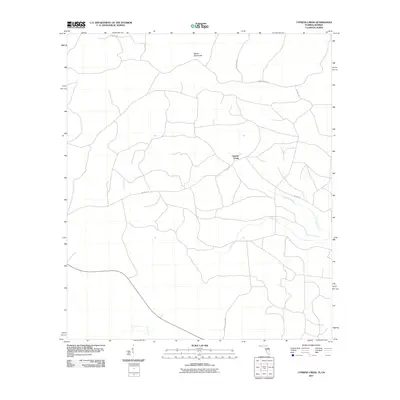
2011 Map of Cypress Creek
USGS Topo · Published 2011About this map
Martin Hammock stands as a prominent terrain feature in this pocket of the Florida-Georgia borderlands during the early twenty-first century. The landscape is defined by the drainage systems of Cypress Creek and Rocky Creek, which snake through the low-lying interior. A network of rural arteries, including Fales Steel Rd and Stewart Rd, provides access across the timberlands and wetlands that characterize this region of Hamilton County. The mapping of Christie Tower Rd and several numeric forest routes like NE 36th Dr reflects a modern era of land management and rural connectivity. This 2011 survey captures the transition of traditional named landmarks into a more structured grid of maintained tracks and county routes, serving as a primary reference for the topography of the northern Panhandle.
Find a feature on this map
10 named features on this map. Tap any name to fly to it.
Don’t see what you’re looking for? This feature index may not catch every label — zoom into the map to look around manually.
Map Details
Editions of this 2011 Cypress Creek Map
This is the sole edition of this map. No revisions or reprints were ever made.
Other maps of this area

1954 · Valdosta
USGS Topo · 1:250,000

1955 · Jasper
USGS Topo · 1:24,000

1955 · Cypress Creek
USGS Topo · 1:24,000

1955 · Fargo SW
USGS Topo · 1:24,000

1958 · Valdosta
USGS Topo · 1:250,000

1959 · Valdosta
USGS Topo · 1:250,000

1961 · Hillcoat
USGS Topo · 1:24,000

1962 · Genoa
USGS Topo · 1:24,000

1968 · Needmore
USGS Topo · 1:24,000
1969 · Benton
USGS Topo · 1:24,000