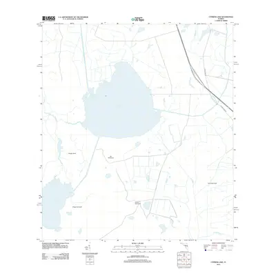
2012 Map of Cypress Lake
USGS Topo · Published 2012About this map
Cypress Lake dominates the center of this Central Florida landscape, its waters fed and drained by a complex network of natural and engineered waterways. To the southwest, the Hatchineha Canal connects this large water body to Lake Hatchineha, illustrating the regional hydrological management that defines this part of Polk County. The terrain is marked by distinctive hammocks—localized elevations of hardwood forest—such as Ike Hammock, Sheep Hammock, and Carson Hammock, which provide vertical relief in an otherwise low-lying area. Toward the eastern edge, Canoe Creek Rd and N Canoe Creek Rd represent the primary transit corridor, while the southeastern corner is defined by the marshy stretches of Coon Hammock and Scrub Slough. This landscape reveals a balance between preserved wetlands, such as Rough Island, and the drainage efforts evidenced by the Short Canal.
Find a feature on this map
14 named features on this map. Tap any name to fly to it.
Don’t see what you’re looking for? This feature index may not catch every label — zoom into the map to look around manually.
Map Details
Editions of this 2012 Cypress Lake Map
This is the sole edition of this map. No revisions or reprints were ever made.
Other maps of this area

1952 · Lake Weohyakapka NE
USGS Topo · 1:24,000

1952 · Hesperides
USGS Topo · 1:24,000

1953 · Lake Marian NW
USGS Topo · 1:24,000

1953 · Cypress Lake
USGS Topo · 1:24,000

1953 · Lake Hatchineha
USGS Topo · 1:24,000

1953 · St Cloud South
USGS Topo · 1:24,000

1953 · Lake Tohopekaliga
USGS Topo · 1:24,000

1953 · Holopaw SW
USGS Topo · 1:24,000

1953 · Ashton
USGS Topo · 1:24,000

1955 · Orlando
USGS Topo · 1:250,000