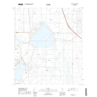
2018 Map of Cypress Lake
USGS Topo · Published 2018About this map
Cypress Lake dominates the central landscape of this Polk and Osceola County border region, serving as a hub for a complex network of waterways including the South Port Canal and Hatchineha Canal. The surrounding terrain is a mosaic of wetlands and hammocks—elevated islands of vegetation that provided dry ground in the watery expanse. Named features like Ike Hammock, Carson Hammock, and Coon Hammock point to the area's long history of local navigation and land use. To the west, the flow of Reedy Creek enters the marshes near Rough Island and Johnson Island, eventually reaching Lake Hatchineha. The presence of the Lonesome Camp Swamp in the northeast and the isolated Sheep Hammock near Cobb Marsh illustrate a landscape largely defined by its interior drainage patterns and seasonal water levels.
Find a feature on this map
29 named features on this map. Tap any name to fly to it.
Don’t see what you’re looking for? This feature index may not catch every label — zoom into the map to look around manually.
Map Details
Editions of this 2018 Cypress Lake Map
This is the sole edition of this map. No revisions or reprints were ever made.
Other maps of this area

1952 · Lake Weohyakapka NE
USGS Topo · 1:24,000

1952 · Hesperides
USGS Topo · 1:24,000

1953 · Lake Marian NW
USGS Topo · 1:24,000

1953 · Cypress Lake
USGS Topo · 1:24,000

1953 · Lake Hatchineha
USGS Topo · 1:24,000

1953 · St Cloud South
USGS Topo · 1:24,000

1953 · Lake Tohopekaliga
USGS Topo · 1:24,000

1953 · Holopaw SW
USGS Topo · 1:24,000

1953 · Ashton
USGS Topo · 1:24,000

1955 · Orlando
USGS Topo · 1:250,000