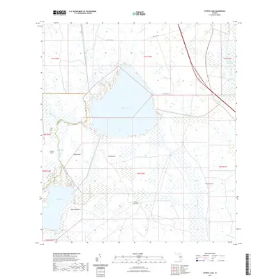
2021 Map of Cypress Lake
USGS Topo · Published 2021About this map
Cypress Lake dominates this Central Florida landscape along the border of Polk and Osceola counties. The hydrological network here is heavily defined by engineered waterways such as the Hatchineha Canal, South Port Canal, and the Short Canal, which regulate the flow between major water bodies like Lake Hatchineha. This pattern of canals and controlled drainage is characteristic of the modern Florida interior, where water management is critical to the surrounding land use. Interspersed throughout the wetlands and marshes are numerous family-named high points or hammocks, including Ike Hammock, Coon Hammock, and Carson Hammock. These features, along with Rough Island and Johnson Island, represent traditional landmarks in a region historically navigated by boat and horseback. To the north, Friar's Cove Rd and Lake Cypress Rd provide the primary terrestrial access to the shoreline in an area otherwise characterized by Cobb Marsh and Scrub Slough.
Find a feature on this map
28 named features on this map. Tap any name to fly to it.
Don’t see what you’re looking for? This feature index may not catch every label — zoom into the map to look around manually.
Map Details
Editions of this 2021 Cypress Lake Map
This is the sole edition of this map. No revisions or reprints were ever made.
Other maps of this area

1952 · Lake Weohyakapka NE
USGS Topo · 1:24,000

1952 · Hesperides
USGS Topo · 1:24,000

1953 · Lake Marian NW
USGS Topo · 1:24,000

1953 · Cypress Lake
USGS Topo · 1:24,000

1953 · Lake Hatchineha
USGS Topo · 1:24,000

1953 · St Cloud South
USGS Topo · 1:24,000

1953 · Lake Tohopekaliga
USGS Topo · 1:24,000

1953 · Holopaw SW
USGS Topo · 1:24,000

1953 · Ashton
USGS Topo · 1:24,000

1955 · Orlando
USGS Topo · 1:250,000