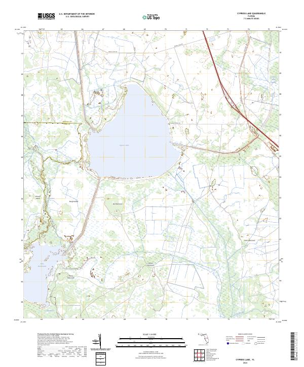
2024 Map of Cypress Lake
USGS Topo · Published 2024About this map
Cypress Lake and Lake Hatchineha dominate this central Florida landscape, joined by a network of engineered waterways and natural drainages. The Hatchineha Canal and South Port Canal underscore the regional history of water management and navigation, while the winding course of Reedy Creek feeds into the northern basin. Much of the eastern terrain is preserved within the Three Lakes Wildlife Management Area, a mosaic of wetlands and hammocks including Ike Hammock and Carson Hammock. These elevated "islands" of vegetation, along with Johnson Island and Rough Island near the Dead River, highlight the traditional topography of the Kissimmee River valley before modern development. To the northeast, the evocatively named Lonesome Camp Swamp remains a pocket of remote wilderness near Canoe Creek and Scrub Slough.
Find a feature on this map
30 named features on this map. Tap any name to fly to it.
Don’t see what you’re looking for? This feature index may not catch every label — zoom into the map to look around manually.
Map Details
Editions of this 2024 Cypress Lake Map
This is the sole edition of this map. No revisions or reprints were ever made.
Other maps of this area

1952 · Lake Weohyakapka NE
USGS Topo · 1:24,000

1952 · Hesperides
USGS Topo · 1:24,000

1953 · Lake Marian NW
USGS Topo · 1:24,000

1953 · Cypress Lake
USGS Topo · 1:24,000

1953 · Lake Hatchineha
USGS Topo · 1:24,000

1953 · St Cloud South
USGS Topo · 1:24,000

1953 · Lake Tohopekaliga
USGS Topo · 1:24,000

1953 · Holopaw SW
USGS Topo · 1:24,000

1953 · Ashton
USGS Topo · 1:24,000

1955 · Orlando
USGS Topo · 1:250,000