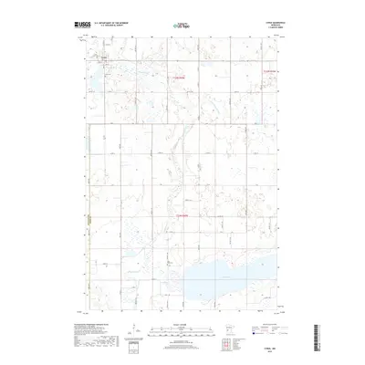
2019 Map of Cyrus
USGS Topo · Published 2019About this map
Cyrus is the primary settlement on this western Minnesota landscape, situated just east of the Stevens Co Pope Co boundary. The town's grid is anchored by a Post Office and residential streets like Dahl St, with the local Saint Petri Cem and Cyrus Cem serving as significant genealogical touchstones. The terrain is defined by a network of glacial waterways, most notably the Chippewa River and the Little Chippewa River, which meander through a countryside marked by numerous wetlands and small depressions.
Find a feature on this map
53 named features on this map. Tap any name to fly to it.
Don’t see what you’re looking for? This feature index may not catch every label — zoom into the map to look around manually.
Map Details
Editions of this 2019 Cyrus Map
This is the sole edition of this map. No revisions or reprints were ever made.
Other maps of this area

1912 · Morris
USGS Topo · 1:62,500

1953 · Saint Cloud
USGS Topo · 1:250,000

1957 · Saint Cloud
USGS Topo · 1:250,000

1958 · Saint Cloud
USGS Topo · 1:250,000

1968 · Cyrus
USGS Topo · 1:24,000

1968 · Starbuck
USGS Topo · 1:24,000

1968 · Lowry
USGS Topo · 1:24,000

1968 · Hancock
USGS Topo · 1:24,000

1968 · Lake Hassel
USGS Topo · 1:24,000

1968 · Starbuck NW
USGS Topo · 1:24,000