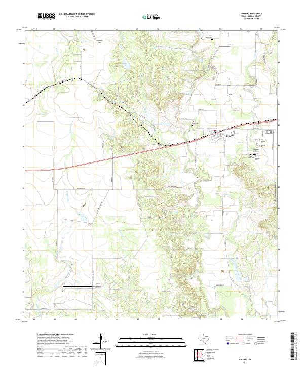
2022 Map of D'Hanis
USGS Topo · Published 2022About this map
D'Hanis is the primary settlement on this Medina County landscape, positioned where the transport corridor of Old Hwy 90 meets a cluster of community landmarks. The area's heritage is deeply visible in its burial grounds, which reflect both local families and civic organizations, including the Rothe Family Cem, Cortez Cem, and the Woodmen of the World Cem. Further spiritual and historical roots are noted at the Saint Dominic Cem, Holy Cross Cem, and San Francisco Cem, all situated near the town center.
Find a feature on this map
65 named features on this map. Tap any name to fly to it.
Don’t see what you’re looking for? This feature index may not catch every label — zoom into the map to look around manually.
Map Details
Editions of this 2022 D'Hanis Map
This is the sole edition of this map. No revisions or reprints were ever made.
Other maps of this area

1928 · Frio Town
USGS Topo · 1:62,500

1954 · San Antonio
USGS Topo · 1:250,000

1956 · Sabinal
USGS Topo · 1:62,500

1956 · New Fountain
USGS Topo · 1:62,500

1957 · San Antonio
USGS Topo · 1:250,000

1964 · Yancey
USGS Topo · 1:24,000

1969 · Sabinal NE
USGS Topo · 1:24,000

1969 · Comanche Waterhole
USGS Topo · 1:24,000
1969 · Mustang Valley
USGS Topo · 1:24,000
1970 · Irishman Hill
USGS Topo · 1:24,000