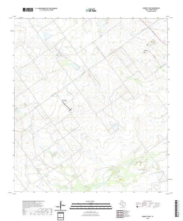
2022 Map of Dabney Tank
USGS Topo · Published 2022About this map
The brush country of Dimmit County unfolds across this survey, centered on the intermittent drainages and ranch infrastructure northwest of Catarina. The landscape is defined by the winding courses of San Roque Cr and Appurceon Cr, which feed several localized impoundments including Stumberg Lake, Beinhorn Lake, and Saunders Lake. These water sources reflect the essential land management required in this semi-arid South Texas region. Regional connectivity is maintained by Ranch Rd 2688, which bisects the quadrangle, while more localized history is found at the Catarina Cem Number 1 located off Cemetery Rd. The presence of the San Ysidro Ranch Airport highlights the importance of private aviation in managing these expansive ranching properties.
Find a feature on this map
12 named features on this map. Tap any name to fly to it.
Don’t see what you’re looking for? This feature index may not catch every label — zoom into the map to look around manually.
Map Details
Editions of this 2022 Dabney Tank Map
This is the sole edition of this map. No revisions or reprints were ever made.
Other maps of this area

1925 · San Roque Lake 1-a
USGS Topo · 1:48,000

1929 · Cotulla
USGS Topo · 1:125,000

1932 · Valley Wells
USGS Topo · 1:62,500

1940 · Asherton
USGS Topo · 1:62,500

1940 · Velenzuela Creek
USGS Topo · 1:62,500

1940 · San Loranzo Creek
USGS Topo · 1:62,500

1940 · Catarina
USGS Topo · 1:62,500

1953 · Crystal City
USGS Topo · 1:250,000

1955 · Crystal City
USGS Topo · 1:250,000

1961 · Crystal City
USGS Topo · 1:250,000