
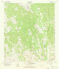
1962 Map of Dacus
USGS Topo · Published 1963About this map
The boundary between Grimes and Montgomery Counties runs through a landscape of creek bottoms and forested ridges in the early 1960s. The settlement of Dacus serves as a small hub along the Fort Worth and Denver (C B & Q) Chicago Rock Island and Pacific railroad, which cuts through the center of the sheet. To the north, the Sam Houston National Forest marks the upper reaches of the terrain, while the southern portion is defined by the winding paths of Little Caney Creek and Caney Creek. Local history is anchored by several rural landmarks, including Mount Mariah Ch and the Post Oak Cem. Farther west, the small community of Blackberry sits near Sand Creek, illustrating the dispersed nature of these East Texas settlements. The map also captures the path of the Gulf Colorado and Santa Fe (A T & S F) railroad as it traverses the southeastern corner.
Find a feature on this map
23 named features on this map. Tap any name to fly to it.
Don’t see what you’re looking for? This feature index may not catch every label — zoom into the map to look around manually.
Map Details
Editions of this 1962 Dacus Map
2 editions found
Other maps of this area

1954 · Beaumont
USGS Topo · 1:250,000

1957 · Beaumont
USGS Topo · 1:250,000

1959 · San Jacinto
USGS Topo · 1:24,000

1959 · Montgomery
USGS Topo · 1:24,000

1961 · Anderson
USGS Topo · 1:24,000

1961 · Stoneham
USGS Topo · 1:24,000

1962 · Keenan
USGS Topo · 1:24,000

1962 · Plantersville
USGS Topo · 1:24,000

1962 · Richards
USGS Topo · 1:24,000
1962 · Roans Prairie
USGS Topo · 1:24,000