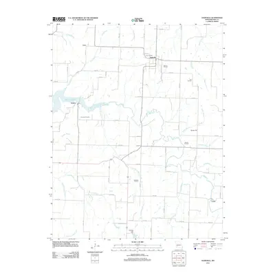
2011 Map of Dadeville
USGS Topo · Published 2011About this map
Dadeville serves as the central hub of this agricultural and riparian landscape, situated at the intersection of local routes like Springfield St and Maple St. The area is defined by the winding course of the Sac River, which flows through the center of the region before meeting the eastern reaches of Stockton Lake near the settlement of Hulston. Historically significant landmarks like Hulston Mill highlight the river's long-standing importance to local industry and community life.
Find a feature on this map
72 named features on this map. Tap any name to fly to it.
Don’t see what you’re looking for? This feature index may not catch every label — zoom into the map to look around manually.
Map Details
Editions of this 2011 Dadeville Map
This is the sole edition of this map. No revisions or reprints were ever made.
Other maps of this area

1886 · Stockton
USGS Topo · 1:125,000

1886 · Greenfield
USGS Topo · 1:125,000

1888 · Greenfield
USGS Topo · 1:125,000

1954 · Springfield
USGS Topo · 1:250,000

1955 · Dadeville
USGS Topo · 1:24,000

1956 · Ash Grove
USGS Topo · 1:24,000
1956 · Walnut Grove
USGS Topo · 1:24,000

1956 · Greenfield
USGS Topo · 1:24,000
1956 · Bona
USGS Topo · 1:24,000
1956 · South Greenfield
USGS Topo · 1:24,000