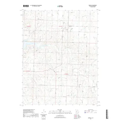
2017 Map of Dadeville
USGS Topo · Published 2017About this map
Corry stands as a primary settlement in this northern section of Dade County, surrounded by a network of local waterways. The terrain is defined by the drainage of various branches, including Birch Br and Gormack Br, which carve through the rural landscape. This modern digital survey from the U.S. Geological Survey integrates contemporary road networks and hydrographic data, providing a precise spatial record of the township and range divisions. The distribution of these named branches suggests the fundamental role of natural drainage in shaping the historical development and current land use patterns of this Missouri interior.
Find a feature on this map
3 named features on this map. Tap any name to fly to it.
Don’t see what you’re looking for? This feature index may not catch every label — zoom into the map to look around manually.
Map Details
Editions of this 2017 Dadeville Map
This is the sole edition of this map. No revisions or reprints were ever made.
Other maps of this area

1886 · Stockton
USGS Topo · 1:125,000

1886 · Greenfield
USGS Topo · 1:125,000

1888 · Greenfield
USGS Topo · 1:125,000

1954 · Springfield
USGS Topo · 1:250,000

1955 · Dadeville
USGS Topo · 1:24,000

1956 · Ash Grove
USGS Topo · 1:24,000
1956 · Walnut Grove
USGS Topo · 1:24,000

1956 · Greenfield
USGS Topo · 1:24,000
1956 · Bona
USGS Topo · 1:24,000
1956 · South Greenfield
USGS Topo · 1:24,000