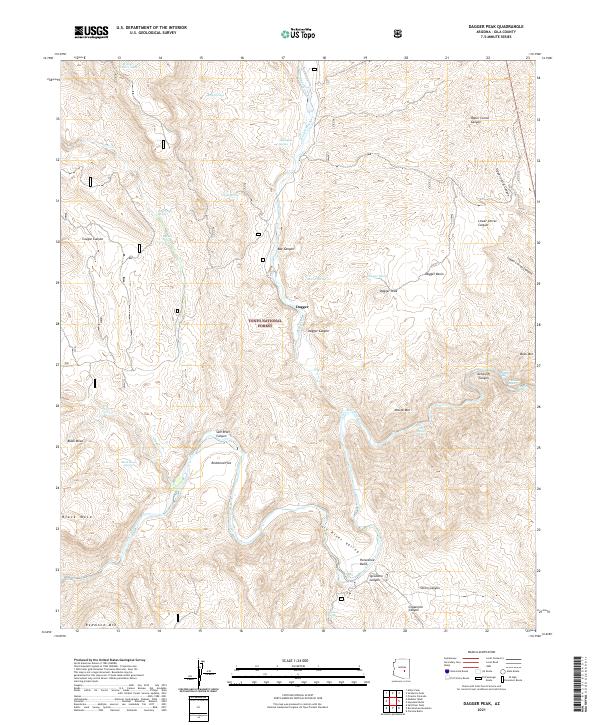
2021 Map of Dagger Peak
USGS Topo · Published 2021About this map
Salt River carves a deep path through the Tonto National Forest in this central Arizona landscape, marked by a series of named whitewater challenges. Navigational landmarks like Cliff Hanger Rapid, The Sleeper Rapid, and Quartzite Rapid indicate the river's dynamic nature through the Salt River Canyon. Settlement is sparse, represented primarily by Redmond Flat and the small station at Dagger, situated in a region where vertical relief dominates.
Find a feature on this map
48 named features on this map. Tap any name to fly to it.
Don’t see what you’re looking for? This feature index may not catch every label — zoom into the map to look around manually.
Map Details
Editions of this 2021 Dagger Peak Map
This is the sole edition of this map. No revisions or reprints were ever made.
Other maps of this area

1922 · Chrysotile
USGS Topo · 1:125,000

1946 · Blue House Mtn
USGS Topo · 1:62,500

1949 · McFadden Peak
USGS Topo · 1:62,500

1949 · Rockinstraw Mtn
USGS Topo · 1:62,500

1950 · Rockinstraw Mtn
USGS Topo · 1:62,500

1950 · McFadden Peak
USGS Topo · 1:62,500

1951 · Blue House Mtn
USGS Topo · 1:62,500

1954 · Mesa
USGS Topo · 1:250,000

1957 · Mesa
USGS Topo · 1:250,000

1958 · Mesa
USGS Topo · 1:250,000