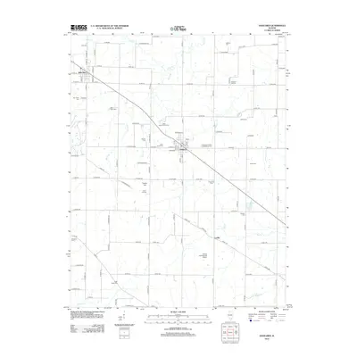
2012 Map of Dahlgren
USGS Topo · Published 2012About this map
Dahlgren stands as the primary hub of this Southern Illinois landscape, where a grid of rural roads connects scattered agricultural homesteads and local landmarks. The area is notable for its high density of family and community burial grounds, such as the Independent Order of Oddfellows Cem and Wall-Farm Cem, reflecting generations of settlement. Transport and recreation are anchored by the Gelfius International Airport and the Little Egypt Youth Camp, while the village of Belle Rive occupies the northwestern corner. The terrain is defined by low-lying drainages including Auxier Cr, Big Cr, and Middle Cr, which flow through a region characterized by gentle elevations like Lowry Hill. This map captures a moment of modern rural continuity, documenting small hamlets like Lovilla and the persistent importance of local landmarks to the county's social geography.
Find a feature on this map
103 named features on this map. Tap any name to fly to it.
Don’t see what you’re looking for? This feature index may not catch every label — zoom into the map to look around manually.
Map Details
Editions of this 2012 Dahlgren Map
This is the sole edition of this map. No revisions or reprints were ever made.
Other maps of this area

1933 · Mount Vernon
USGS Topo · 1:48,000

1939 · Ina
USGS Topo · 1:62,500

1940 · Mount Vernon
USGS Topo · 1:62,500

1942 · McLeansboro
USGS Topo · 1:62,500

1943 · Ina
USGS Topo · 1:62,500

1945 · McLeansboro
USGS Topo · 1:62,500

1947 · Wayne City
USGS Topo · 1:62,500

1958 · Belleville
USGS Topo · 1:250,000

1962 · Belleville
USGS Topo · 1:250,000

1964 · Opdyke
USGS Topo · 1:24,000