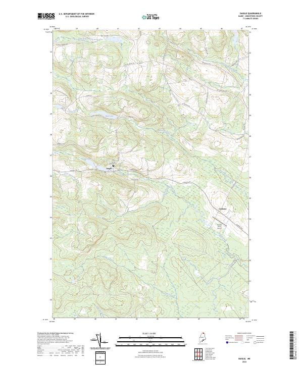
2024 Map of Daigle
USGS Topo · Published 2024About this map
Daigle and Ouellette anchor this section of Aroostook County, where the landscape is defined by the winding paths of West Fork Dickey Brook and Pelletier Brook. The area's cultural history is centered near the junction of Caribou Rd and Cemetery Hill Rd, home to the Holy Family Catholic Cem. This modern topographic study reveals a rural network of family-named roads like Roy Rd, Morneault Rd, and Gagnon Ave, which snake through the timbered hills and wetlands surrounding Daigle Pond and Black Lake. The presence of the Sunrise Farms Airport near Ouellette highlights the continued importance of small-scale aviation in accessing this northern terrain. Further south, the map traces the headwaters of numerous drainages, including Dimock Brook and Snare Brook, illustrating the complex hydrology that feeds the region's larger river systems.
Find a feature on this map
40 named features on this map. Tap any name to fly to it.
Don’t see what you’re looking for? This feature index may not catch every label — zoom into the map to look around manually.
Map Details
Editions of this 2024 Daigle Map
This is the sole edition of this map. No revisions or reprints were ever made.
Other maps of this area

1927 · Square Lake
USGS Topo · 1:48,000

1928 · Eagle Lake
USGS Topo · 1:48,000

1931 · Square Lake
USGS Topo · 1:62,500

1931 · Eagle Lake
USGS Topo · 1:62,500

1932 · Frenchville
USGS Topo · 1:48,000

1932 · Fort Kent
USGS Topo · 1:48,000

1935 · Fort Kent
USGS Topo · 1:62,500

1935 · Frenchville
USGS Topo · 1:62,500

1953 · Square Lake
USGS Topo · 1:62,500

1962 · Edmundston
USGS Topo · 1:250,000