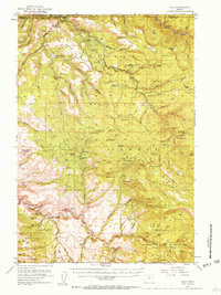
1951 Map of Dale
USGS Topo · Published 1958About this map
The John Day River winds through the northern reaches of this landscape, where the Dale Ranger Sta stands as a primary outpost within the Umatilla National Forest. In the early 1950s, this area of the Blue Mountains was defined by a network of logging and resource extraction camps, including Peep Creek Camp, Welch Creek Camp, and Keeney Camp. The map documents the high-country meadow systems like Duff Meadows and Round Meadows that dot the ridges between Desolation Creek and Meadow Brook.
Find a feature on this map
111 named features on this map. Tap any name to fly to it.
Don’t see what you’re looking for? This feature index may not catch every label — zoom into the map to look around manually.
Map Details
Editions of this 1951 Dale Map
4 editions found
Other maps of this area

1949 · Long Creek
USGS Topo · 1:62,500

1949 · Susanville
USGS Topo · 1:62,500

1950 · Ritter
USGS Topo · 1:62,500

1951 · Susanville
USGS Topo · 1:62,500

1951 · Long Creek
USGS Topo · 1:62,500

1951 · Dale
USGS Topo · 1:62,500

1951 · Bates
USGS Topo · 1:62,500

1951 · Desolation Butte
USGS Topo · 1:62,500

1952 · Ritter
USGS Topo · 1:62,500

1953 · Pendleton
USGS Topo · 1:250,000