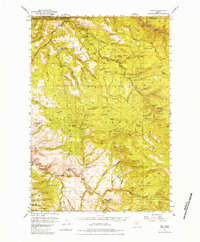
1951 Map of Dale
USGS Topo · Published 1984About this map
The North Fork John Day River and its numerous tributaries dominate this mid-century portrait of northeastern Oregon’s high timber country. Centered on the settlement of Dale, the terrain is defined by the intersections of the Umatilla National Forest, Whitman National Forest, and Malheur National Forest. The landscape reveals a network of high-elevation meadows and seasonal encampments, including Howard Meadows, Wassen Meadows, and Bear Camp, which speak to the area's long-standing use for summer grazing and forestry operations.
Find a feature on this map
68 named features on this map. Tap any name to fly to it.
Don’t see what you’re looking for? This feature index may not catch every label — zoom into the map to look around manually.
Map Details
Editions of this 1951 Dale Map
4 editions found
Other maps of this area

1949 · Long Creek
USGS Topo · 1:62,500

1949 · Susanville
USGS Topo · 1:62,500

1950 · Ritter
USGS Topo · 1:62,500

1951 · Susanville
USGS Topo · 1:62,500

1951 · Long Creek
USGS Topo · 1:62,500

1951 · Dale
USGS Topo · 1:62,500

1951 · Bates
USGS Topo · 1:62,500

1951 · Desolation Butte
USGS Topo · 1:62,500

1952 · Ritter
USGS Topo · 1:62,500

1953 · Pendleton
USGS Topo · 1:250,000