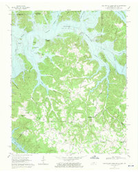
1968 Map of Dale Hollow Reservoir SE
USGS Topo · Published 1971About this map
The Dale Hollow Reservoir dominates this landscape, its waters filling the deep valleys of the Wolf River and Obey River along the Kentucky-Tennessee border. In this mid-century survey, the reservoir's controlled inundation to 663 feet is captured, showing the many islands it created such as Opossum Island and Goat Island. The map provides a detailed view of local community hubs like Willow Grove and Colson, as well as numerous rural institutions including Mt Pisgah Ch and Maple Grove Sch. Geologically, the area is defined by sharp topographic contrasts, from the high elevation of Chowning Knob to the water-carved Accordion Bluff overlooking the reservoir. Researchers can trace the network of backroads and jeep trails that connected upland settlements like Oakley and Fairview to the various branches and forks of the surrounding river system.
Find a feature on this map
57 named features on this map. Tap any name to fly to it.
Don’t see what you’re looking for? This feature index may not catch every label — zoom into the map to look around manually.
Map Details
Editions of this 1968 Dale Hollow Reservoir SE Map
2 editions found
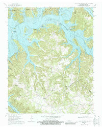
Other maps of this area

1897 · Standingstone
USGS Topo · 1:125,000

1898 · Standingstone
USGS Topo · 1:125,000

1924 · Lillydale
USGS Topo · 1:62,500

1926 · Lillydale
USGS Topo · 1:62,500

1929 · Lillydale
USGS Topo · 1:62,500

1929 · Byrdstown
USGS Topo · 1:62,500

1944 · Livingston
USGS Topo · 1:24,000

1954 · Frogue
USGS Topo · 1:24,000

1954 · Blacks Ferry
USGS Topo · 1:24,000

1954 · Albany
USGS Topo · 1:24,000