
1962 Map of Daleville
USGS Topo · Published 1963About this map
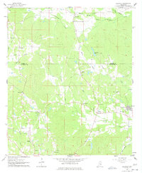
Ponta Creek and its many tributaries, including Baker Creek and Wright Creek, carve through the landscape along the county line between Kemper and Lauderdale counties. In the early 1960s, this area is characterized by a high density of rural community centers, each anchored by a local church or cemetery. Significant burial sites such as the Samuel Dale Cem and Daleville Cem are prominent near the settlement of Daleville, while numerous small houses of worship like Ebenezer Ch, Tabernacle Ch, and Andrews Chapel dot the surrounding hills. This survey records the rural layout before major modern development, capturing the network of unpaved roads and local Sandpits that supported the local economy. The southeastern corner shows the encroaching influence of the nearby Naval Air Station, marking the intersection of traditional southern rural life and mid-century military expansion.
Find a feature on this map
32 named features on this map. Tap any name to fly to it.
Don’t see what you’re looking for? This feature index may not catch every label — zoom into the map to look around manually.
Map Details
Editions of this 1962 Daleville Map
4 editions found
Other maps of this area

1921 · Meridian
USGS Topo · 1:48,000

1923 · Meridian
USGS Topo · 1:62,500

1953 · Meridian
USGS Topo · 1:250,000

1957 · Meridian
USGS Topo · 1:250,000

1957 · Chunky
USGS Topo · 1:62,500

1962 · Lauderdale
USGS Topo · 1:24,000

1962 · Lauderdale NW
USGS Topo · 1:24,000

1962 · Center Hill
USGS Topo · 1:24,000

1962 · Oak Grove
USGS Topo · 1:24,000

1962 · Moscow
USGS Topo · 1:24,000