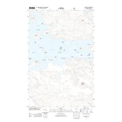
2013 Map of Daley Bay
USGS Topo · Published 2013About this map
Kabetogama Lake dominates this northern Minnesota landscape, creating a complex archipelago of named islands and points that define the geography of Saint Louis County. This survey highlights the intricate shoreline where Nashata Point and Martin Island sit among dozens of smaller landforms like Grave Island and Sugarbush Island. To the east, the terrain rises toward the Shoepack Lookout Tower, overlooking Shoepack Lake and its smaller neighbor, Little Shoepack Lake.
Find a feature on this map
40 named features on this map. Tap any name to fly to it.
Don’t see what you’re looking for? This feature index may not catch every label — zoom into the map to look around manually.
Map Details
Editions of this 2013 Daley Bay Map
This is the sole edition of this map. No revisions or reprints were ever made.
Other maps of this area

1954 · International Falls
USGS Topo · 1:250,000

1957 · International Falls
USGS Topo · 1:250,000

1958 · International Falls
USGS Topo · 1:250,000

1967 · Kempton Bay
USGS Topo · 1:24,000

1968 · Soldier Point
USGS Topo · 1:24,000

1968 · Daley Bay
USGS Topo · 1:24,000

1968 · Ash River SE
USGS Topo · 1:24,000

1968 · Ash River NE
USGS Topo · 1:24,000

1968 · Ash River SW
USGS Topo · 1:24,000

1969 · Ray SE
USGS Topo · 1:24,000