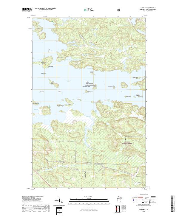
2022 Map of Daley Bay
USGS Topo · Published 2022About this map
Voyageurs National Park and Superior National Forest intersect in this watery landscape defined by the expansive Kabetogama Lake. The area is characterized by a dense archipelago of islands with evocative names like Sugarbush Island, Grave Island, and Potato Island, reflecting the complex shoreline and navigation challenges of these northern waters. While the northern half is dominated by bays such as Slátinski Bay and Daley Bay, the southern terrain transitions into forest land managed for recreation and conservation. Modern transportation patterns are visible through the network of recreational corridors, including the David Dill-Arrowhead State Trl and the Voyageur Snowmobile Trl, which weave through the timber alongside the Ash River Trl. This documentation captures the area's contemporary state as a preserved wilderness region where land and water are inextricably linked.
Find a feature on this map
56 named features on this map. Tap any name to fly to it.
Don’t see what you’re looking for? This feature index may not catch every label — zoom into the map to look around manually.
Map Details
Editions of this 2022 Daley Bay Map
This is the sole edition of this map. No revisions or reprints were ever made.
Other maps of this area

1954 · International Falls
USGS Topo · 1:250,000

1957 · International Falls
USGS Topo · 1:250,000

1958 · International Falls
USGS Topo · 1:250,000

1967 · Kempton Bay
USGS Topo · 1:24,000

1968 · Soldier Point
USGS Topo · 1:24,000

1968 · Daley Bay
USGS Topo · 1:24,000

1968 · Ash River SE
USGS Topo · 1:24,000

1968 · Ash River NE
USGS Topo · 1:24,000

1968 · Ash River SW
USGS Topo · 1:24,000

1969 · Ray SE
USGS Topo · 1:24,000