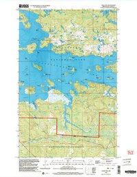
1999 Map of Daley Bay
USGS Topo · Published 2003About this map
Voyageurs National Park and the Kabetogama State Forest dominate this northern landscape, where the waters of Kabetogama Lake are punctuated by a dense archipelago of named islands and rocky points. The map details a complex shoreline of deep inlets like Irwin Bay, Bowman Bay, and Duck Bay, separated by peninsulas such as Nashata Point. The interior terrain is characterized by a series of smaller inland bodies of water, including Shoepack Lake and Little Shoepack Lake, alongside the courses of Clyde Creek and Deer Creek. Evidence of local industry is sparse but present at a Gravel Pit near the southern boundary, while recreational access is highlighted by several designated Campsite locations scattered across islands like Cutover Island and Sugarbush Island. This survey provides a meticulous record of the lake's geography before the turn of the 21st century, showing the intricate relationship between the park boundaries and the surrounding forest lands.
Find a feature on this map
51 named features on this map. Tap any name to fly to it.
Don’t see what you’re looking for? This feature index may not catch every label — zoom into the map to look around manually.
Map Details
Editions of this 1999 Daley Bay Map
This is the sole edition of this map. No revisions or reprints were ever made.
Other maps of this area

1954 · International Falls
USGS Topo · 1:250,000

1957 · International Falls
USGS Topo · 1:250,000

1958 · International Falls
USGS Topo · 1:250,000

1967 · Kempton Bay
USGS Topo · 1:24,000

1968 · Soldier Point
USGS Topo · 1:24,000

1968 · Daley Bay
USGS Topo · 1:24,000

1968 · Ash River SE
USGS Topo · 1:24,000

1968 · Ash River NE
USGS Topo · 1:24,000

1968 · Ash River SW
USGS Topo · 1:24,000

1969 · Ray SE
USGS Topo · 1:24,000