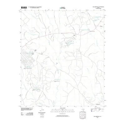
2010 Map of Dallardsville
USGS Topo · Published 2010About this map
Dallardsville and the nearby Indian Village anchor this corner of Polk County, where a complex network of small lakes and reservoirs defines the drainage of Big Sandy Creek. In the decade after the millennium, the landscape shows a mix of rural settlement and forestry infrastructure, with numerous timber-hauling routes such as Old Tram Rd and Timber Rd crisscrossing the piney woods. Many of the local water bodies, including Tombigbee Lake, Wilson Lake, and Wild Indian Lake, are managed by dam and levee systems like the Lovell Reservoir Number 2 Levee. For genealogists, the map preserves the location of Midway Cemetery and the enclave of Camp Ruby, providing a detailed look at the local road network that connects these scattered communities to the larger state routes like FM 1276.
Find a feature on this map
60 named features on this map. Tap any name to fly to it.
Don’t see what you’re looking for? This feature index may not catch every label — zoom into the map to look around manually.
Map Details
Editions of this 2010 Dallardsville Map
This is the sole edition of this map. No revisions or reprints were ever made.
Other maps of this area

1954 · Beaumont
USGS Topo · 1:250,000

1955 · Camden
USGS Topo · 1:62,500

1955 · New Willard
USGS Topo · 1:62,500

1957 · Beaumont
USGS Topo · 1:250,000

1958 · Livingston
USGS Topo · 1:62,500

1958 · Segno
USGS Topo · 1:62,500

1984 · Segno
USGS Topo · 1:24,000

1984 · Hortense
USGS Topo · 1:24,000

1984 · Soda
USGS Topo · 1:24,000

1984 · Beaumont
USGS Topo · 1:250,000