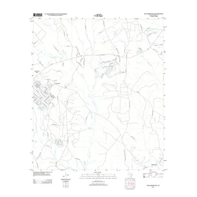
2013 Map of Dallardsville
USGS Topo · Published 2013About this map
New Camp Ruby and the adjacent Camp Ruby anchor the western portion of this Polk County landscape, where the dense hydrology of the Big Thicket is on full display. The area is defined by a intricate network of waterways including Big Sandy Cr, Bear Cr, and Johnson's Mill Cr, which feed into numerous small bodies of water like Wild Indian Lake and Wilson Lake. The southern edge of the map transitions into the protected lands of the Big Thicket National Preserve, illustrating the region's commitment to conserving its unique ecosystem.
Find a feature on this map
103 named features on this map. Tap any name to fly to it.
Don’t see what you’re looking for? This feature index may not catch every label — zoom into the map to look around manually.
Map Details
Editions of this 2013 Dallardsville Map
This is the sole edition of this map. No revisions or reprints were ever made.
Other maps of this area

1954 · Beaumont
USGS Topo · 1:250,000

1955 · Camden
USGS Topo · 1:62,500

1955 · New Willard
USGS Topo · 1:62,500

1957 · Beaumont
USGS Topo · 1:250,000

1958 · Livingston
USGS Topo · 1:62,500

1958 · Segno
USGS Topo · 1:62,500

1984 · Segno
USGS Topo · 1:24,000

1984 · Hortense
USGS Topo · 1:24,000

1984 · Soda
USGS Topo · 1:24,000

1984 · Beaumont
USGS Topo · 1:250,000