
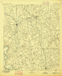
1891 Map of Dallas
USGS Topo · Published 1891About this map
Dallas and its surrounding countryside are captured here during a pivotal decade of expansion, long before the city’s footprint covered the county. The map highlights the early separation between the main city and Oak Cliff, with the Trinity River and its expansive bottomlands serving as a natural divide. This era is defined by a dense radial network of railroads, including the Texas and Pacific Railway and the Houston and Texas Central Railway, which spurred the growth of satellite settlements like Richardson and Garland.
Find a feature on this map
82 named features on this map. Tap any name to fly to it.
Don’t see what you’re looking for? This feature index may not catch every label — zoom into the map to look around manually.
Map Details
Editions of this 1891 Dallas Map
This is the sole edition of this map. No revisions or reprints were ever made.
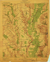
Other maps of this area

1891 · Cleburne
USGS Topo · 1:125,000

1893 · Dallas
USGS Topo · 1:125,000
1894 · Cleburne
USGS Topo · 1:125,000

1894 · Fort Worth
USGS Topo · 1:125,000
1912 · Rockwall
USGS Topo · 1:31,680

1919 · Royse City
USGS Topo · 1:62,500

1924 · Farmersville 3-c
USGS Topo · 1:48,000

1924 · Mc Kinney 4-d
USGS Topo · 1:48,000

1925 · Mc Kinney 3-c
USGS Topo · 1:48,000
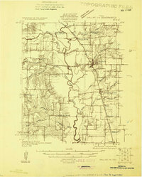
1925 · Dallas 2-b
USGS Topo · 1:48,000