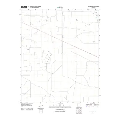
2010 Map of Dallas Store
USGS Topo · Published 2010About this map
The oil-rich plains of Lea County are defined by a network of energy extraction and isolated ranching outposts. Industrial development is prominent across the landscape, with the Bagley Oil Field, Bagley West Oil Field, and Bagley North Oil Field anchoring the region's economy. These fields are interconnected by a grid of county roads, including County Rd-155 and County Rd-157, which navigate the flat terrain and serve both the petroleum industry and local livestock operations.
Find a feature on this map
20 named features on this map. Tap any name to fly to it.
Don’t see what you’re looking for? This feature index may not catch every label — zoom into the map to look around manually.
Map Details
Editions of this 2010 Dallas Store Map
This is the sole edition of this map. No revisions or reprints were ever made.
Other maps of this area

1954 · Brownfield
USGS Topo · 1:250,000

1958 · Brownfield
USGS Topo · 1:250,000

1961 · Johnson Ranch
USGS Topo · 1:24,000

1962 · Brownfield
USGS Topo · 1:250,000

1970 · Johnson Ranch
USGS Topo · 1:24,000

1970 · Simanola Valley
USGS Topo · 1:24,000

1970 · Alston Ranch
USGS Topo · 1:24,000

1973 · Soldier Hill
USGS Topo · 1:24,000

1973 · Caprock
USGS Topo · 1:24,000

1973 · Cooper-Good Ranch
USGS Topo · 1:24,000