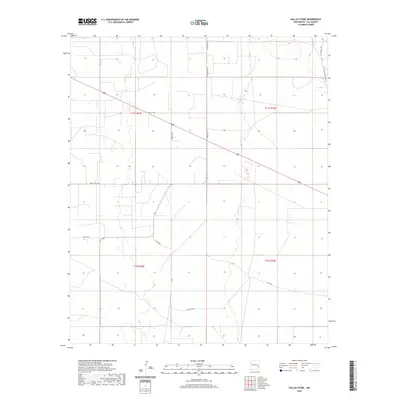
2020 Map of Dallas Store
USGS Topo · Published 2020About this map
Dallas Store serves as the central landmark for this section of the High Plains in Lea County, situated along the primary thoroughfare of US Highway 380. The landscape is defined by large-scale ranching operations, with several family and ranch names preserved on the map through local access roads. Notable ranching interests include Wines Ranch in the north and the extensive Nine Ranch property, which is also identified by its specific legal township marker as T15S Nine Ranch. The grid-like division of the land is further articulated by roads such as Epperson Ln and Bagley Field Rd, illustrating the intersection of modern logistics and traditional land use. In the northeast corner, T161 Four Lakes Rd points toward the drainage patterns of the Llano Estacado, an area where water resources traditionally dictated the placement of early settlements and stock tanks.
Find a feature on this map
17 named features on this map. Tap any name to fly to it.
Don’t see what you’re looking for? This feature index may not catch every label — zoom into the map to look around manually.
Map Details
Editions of this 2020 Dallas Store Map
This is the sole edition of this map. No revisions or reprints were ever made.
Other maps of this area

1954 · Brownfield
USGS Topo · 1:250,000

1958 · Brownfield
USGS Topo · 1:250,000

1961 · Johnson Ranch
USGS Topo · 1:24,000

1962 · Brownfield
USGS Topo · 1:250,000

1970 · Johnson Ranch
USGS Topo · 1:24,000

1970 · Simanola Valley
USGS Topo · 1:24,000

1970 · Alston Ranch
USGS Topo · 1:24,000

1973 · Soldier Hill
USGS Topo · 1:24,000

1973 · Caprock
USGS Topo · 1:24,000

1973 · Cooper-Good Ranch
USGS Topo · 1:24,000