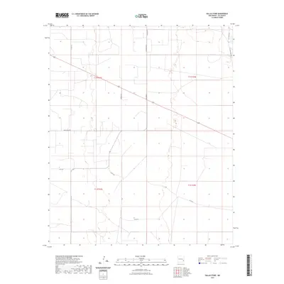
2023 Map of Dallas Store
USGS Topo · Published 2023About this map
Wines Ranch and Nine Ranch characterize this high plains section of Lea County, where ranching infrastructure and local transport networks intersect. The landscape is structured by a grid of county thoroughfares and private access roads, including Bagley Field Rd and Epperson Ln, which connect isolated homesteads and ranching operations. The presence of T167 Four Lakes Rd in the northeast corner suggests the proximity of water resources in an otherwise arid environment. This 2023 survey by the United States Geological Survey provides a clear view of the township and range divisions, specifically within t11s r33e and surrounding sections, illustrating how modern property boundaries follow the traditional Public Land Survey System. The network of secondary roads like Co Rd 158 and Co Rd 153 reveals the persistent utility of rural corridors in managing this expansive New Mexico terrain.
Find a feature on this map
14 named features on this map. Tap any name to fly to it.
Don’t see what you’re looking for? This feature index may not catch every label — zoom into the map to look around manually.
Map Details
Editions of this 2023 Dallas Store Map
This is the sole edition of this map. No revisions or reprints were ever made.
Other maps of this area

1954 · Brownfield
USGS Topo · 1:250,000

1958 · Brownfield
USGS Topo · 1:250,000

1961 · Johnson Ranch
USGS Topo · 1:24,000

1962 · Brownfield
USGS Topo · 1:250,000

1970 · Johnson Ranch
USGS Topo · 1:24,000

1970 · Simanola Valley
USGS Topo · 1:24,000

1970 · Alston Ranch
USGS Topo · 1:24,000

1973 · Soldier Hill
USGS Topo · 1:24,000

1973 · Caprock
USGS Topo · 1:24,000

1973 · Cooper-Good Ranch
USGS Topo · 1:24,000