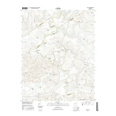
2016 Map of Dalton
USGS Topo · Published 2016About this map
The Tradewater River meanders sharply through the heart of this Western Kentucky landscape, defining the borders between Caldwell, Webster, and Hopkins Counties. The river's winding path is punctuated by historic crossing points such as Utley Ford, Smith Ford, and Tom Gray Ford, suggesting a long-standing reliance on these natural transit corridors before modern bridge infrastructure. At Tayloe Bend, the river's serpentine loops create isolated pockets of bottomland, contrasted by the rising elevations of Hickory Ridge and Sugar Ridge.
Find a feature on this map
96 named features on this map. Tap any name to fly to it.
Don’t see what you’re looking for? This feature index may not catch every label — zoom into the map to look around manually.
Map Details
Editions of this 2016 Dalton Map
This is the sole edition of this map. No revisions or reprints were ever made.
Other maps of this area

1907 · Earlington
USGS Topo · 1:48,000

1908 · Princeton
USGS Topo · 1:62,500

1909 · Dawson Springs
USGS Topo · 1:48,000

1909 · Earlington
USGS Topo · 1:62,500

1909 · Providence
USGS Topo · 1:62,500

1910 · Princeton
USGS Topo · 1:62,500

1911 · Dawson Springs
USGS Topo · 1:62,500

1954 · Evansville
USGS Topo · 1:250,000
1954 · Nebo
USGS Topo · 1:24,000
1954 · Shady Grove
USGS Topo · 1:24,000