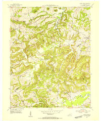
1954 Map of Shady Grove
USGS Topo · Published 1955About this map
Crittenden and Caldwell counties meet in this mid-century portrait of a rural landscape defined by narrow valleys and prominent knobs. Small crossroads communities like Tribune, Deanwood, and Shady Grove serve as anchors for a network of winding roads that follow the contours of the land. The presence of numerous family burial grounds and houses of worship, such as Olive Branch Cem, Travis Cem, and Sugar Grove Ch, indicates a deeply rooted agricultural society.
Find a feature on this map
71 named features on this map. Tap any name to fly to it.
Don’t see what you’re looking for? This feature index may not catch every label — zoom into the map to look around manually.
Map Details
Editions of this 1954 Shady Grove Map
Other maps of this area

1908 · Princeton
USGS Topo · 1:62,500

1909 · Providence
USGS Topo · 1:62,500

1910 · Princeton
USGS Topo · 1:62,500

1916 · Fords Ferry
USGS Topo · 1:62,500

1921 · Fords Ferry
USGS Topo · 1:48,000

1925 · Cave In Rock
USGS Topo · 1:62,500

1928 · Eddyville
USGS Topo · 1:48,000

1931 · Eddyville
USGS Topo · 1:62,500

1936 · Eddyville
USGS Topo · 1:48,000

1949 · Paducah
USGS Topo · 1:250,000