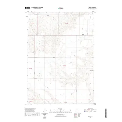
2017 Map of Dalzell
USGS Topo · Published 2017About this map
The Dalzell settlement serves as the primary focal point of this South Dakota landscape, situated within a topography defined by drainage basins and prairie plateaus. To the northwest, the Belle Fourche River cuts across the corner of the map, while numerous ephemeral waterways like Bradley Draw and Trussman Draw segment the plains. The road network, including Dalzell Rd and Smithville Rd, reflects a pattern of rural connectivity established along section lines and geographic features. Notable landmarks such as Shepherd Flat and Sand Springs Draw indicate the historical reliance on local water sources and natural landforms for navigation and naming conventions in Meade County. This 2017 record preserves the modern spatial arrangement of ranches and local infrastructure across the western South Dakota prairie.
Find a feature on this map
20 named features on this map. Tap any name to fly to it.
Don’t see what you’re looking for? This feature index may not catch every label — zoom into the map to look around manually.
Map Details
Editions of this 2017 Dalzell Map
This is the sole edition of this map. No revisions or reprints were ever made.
Other maps of this area

1953 · Rapid City
USGS Topo · 1:250,000

1954 · Dalzell SE
USGS Topo · 1:24,000

1954 · Dalzell NW
USGS Topo · 1:24,000

1954 · Wasta NE
USGS Topo · 1:24,000

1954 · Dalzell
USGS Topo · 1:24,000

1954 · Wasta NW
USGS Topo · 1:24,000

1954 · Dalzell NE
USGS Topo · 1:24,000

1954 · Elm Springs
USGS Topo · 1:24,000

1954 · Boneita Springs
USGS Topo · 1:24,000

1957 · Rapid City
USGS Topo · 1:250,000