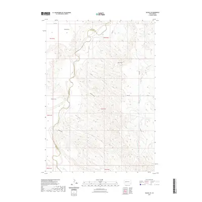
2021 Map of Dalzell SE
USGS Topo · Published 2021About this map
The Cheyenne River snakes through the high plains of Pennington and Meade counties, carving a deep valley that defines the local landscape. This 2021 survey reveals a territory marked by significant elevation changes, where the river's path is flanked by high landmarks like Poverty Point and Marvin Butte. The drainage patterns are clearly etched into the terrain, with Big Canyon and Little Canyon feeding toward the river from the south, while Dalzell Canyon and Cedar Breaks Cr dominate the northern and eastern reaches.
Find a feature on this map
21 named features on this map. Tap any name to fly to it.
Don’t see what you’re looking for? This feature index may not catch every label — zoom into the map to look around manually.
Map Details
Editions of this 2021 Dalzell SE Map
This is the sole edition of this map. No revisions or reprints were ever made.
Other maps of this area

1953 · Rapid City
USGS Topo · 1:250,000

1954 · Dalzell SE
USGS Topo · 1:24,000

1954 · Dalzell NW
USGS Topo · 1:24,000

1954 · Wasta NE
USGS Topo · 1:24,000

1954 · Dalzell
USGS Topo · 1:24,000

1954 · Wasta NW
USGS Topo · 1:24,000

1954 · Dalzell NE
USGS Topo · 1:24,000

1955 · Pedro NW
USGS Topo · 1:24,000

1955 · Creighton
USGS Topo · 1:24,000

1957 · Rapid City
USGS Topo · 1:250,000