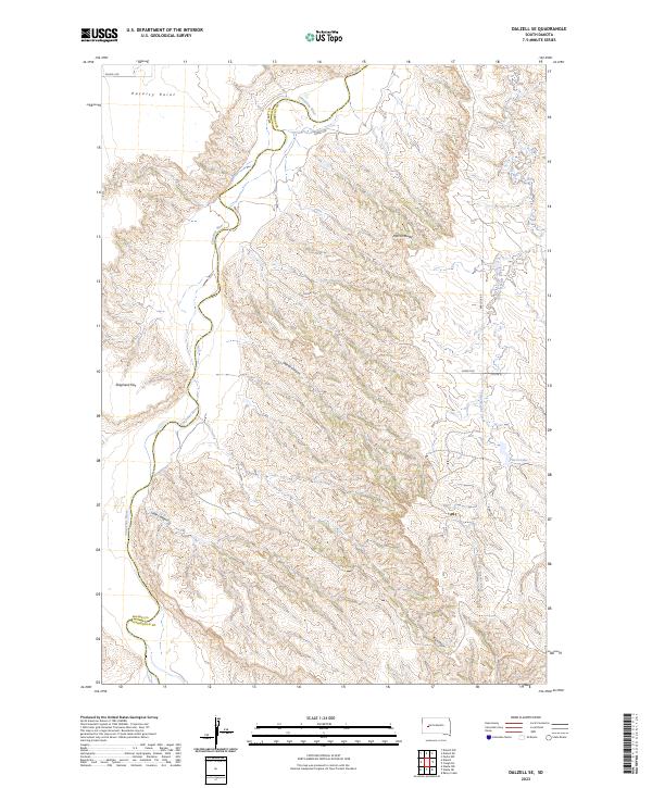
2023 Map of Dalzell SE
USGS Topo · Published 2023About this map
The Cheyenne River winds through this West River landscape, carving a deep valley that defines the boundary between Meade and Pennington counties. This topographic study reveals a dissected terrain where high points like Marvin Butte and Poverty Point overlook a network of seasonal drainages. The eastern portion of the sheet is marked by the headwaters of Cedar Breaks Creek and the presence of Pierce Lake, providing a contrast to the dry canyons that score the western uplands. Transport in this isolated ranching country is dictated by the geography, with Dalzell Rd and Cheney Rd following the more accessible ridges and flats. Named features such as Shepherd Flat and Dalzell Canyon reflect the local heritage of land use in a region where water sources and topographic shelter were vital for settlement and livestock management.
Find a feature on this map
20 named features on this map. Tap any name to fly to it.
Don’t see what you’re looking for? This feature index may not catch every label — zoom into the map to look around manually.
Map Details
Editions of this 2023 Dalzell SE Map
This is the sole edition of this map. No revisions or reprints were ever made.
Other maps of this area

1953 · Rapid City
USGS Topo · 1:250,000

1954 · Dalzell SE
USGS Topo · 1:24,000

1954 · Dalzell NW
USGS Topo · 1:24,000

1954 · Wasta NE
USGS Topo · 1:24,000

1954 · Dalzell
USGS Topo · 1:24,000

1954 · Wasta NW
USGS Topo · 1:24,000

1954 · Dalzell NE
USGS Topo · 1:24,000

1955 · Pedro NW
USGS Topo · 1:24,000

1955 · Creighton
USGS Topo · 1:24,000

1957 · Rapid City
USGS Topo · 1:250,000