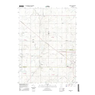
2016 Map of Damascus
USGS Topo · Published 2016About this map
Damascus sits at the intersection of the Mahoning Co and Columbiana Co line, serving as a central hub for this agricultural and small-town landscape. The area is characterized by a series of long-standing rural settlements including Patmos, Snodes, East Goshen, and Garfield. Transportation history is visible through the path of the Pennsylvania RR cutting through the southwest near Beloit, while local aviation is represented by small fields like Tri-City Airport and Koons Airport. Genealogists will find several burial sites preserved in the landscape, such as the Damascus Cem and the East-Goshen Friends Cem. The natural geography is defined by drainage systems like Mill Creek and the Middle Fork Little Beaver Cr, alongside unique features like the Garfield Bog and several small reservoirs including Westville Lake and Sevakeen Lake.
Find a feature on this map
136 named features on this map. Tap any name to fly to it.
Don’t see what you’re looking for? This feature index may not catch every label — zoom into the map to look around manually.
Map Details
Editions of this 2016 Damascus Map
This is the sole edition of this map. No revisions or reprints were ever made.
Other maps of this area

1906 · Ravenna
USGS Topo · 1:62,500

1908 · Warren
USGS Topo · 1:62,500

1908 · Ravenna
USGS Topo · 1:62,500

1909 · Alliance
USGS Topo · 1:62,500

1909 · Lisbon
USGS Topo · 1:62,500

1950 · Cleveland
USGS Topo · 1:250,000

1951 · Canton
USGS Topo · 1:250,000

1952 · Lake Milton
USGS Topo · 1:24,000

1952 · Canfield
USGS Topo · 1:24,000

1952 · Alliance
USGS Topo · 1:24,000