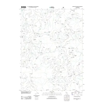
2012 Map of Damnation Peak
USGS Topo · Published 2012About this map
Tollhouse sits as a central landmark in this high-altitude landscape of the early 2010s, where seasonal grazing and forest management define the land use. The map details a network of specialized sites including Heavey Sheep Camp and Sugar Pine Sheep Camp, indicating the ongoing importance of livestock movement through the mountainous terrain. Water sources are critical in this environment, with Trinity Lake appearing at the northwest corner and numerous springs such as Grouse Spring and Quartz Spring dotting the ridges. The topography is dominated by prominent summits and crossings, from Damnation Peak and Blue Mountain to the high saddle of Sanford Pass. A dense web of forest service routes, including Slate Mountain Rd and Dog Creek Rd, provides access to these remote reaches of the Shasta region, connecting gulches like Professor Gulch to established camps like Fool Gulch Camp.
Find a feature on this map
109 named features on this map. Tap any name to fly to it.
Don’t see what you’re looking for? This feature index may not catch every label — zoom into the map to look around manually.
Map Details
Editions of this 2012 Damnation Peak Map
This is the sole edition of this map. No revisions or reprints were ever made.
Other maps of this area

1886 · Shasta
USGS Topo · 1:250,000

1890 · Red Bluff
USGS Topo · 1:250,000

1894 · Red Bluff
USGS Topo · 1:250,000

1894 · Shasta
USGS Topo · 1:250,000

1901 · Redding
USGS Topo · 1:125,000

1913 · Weaverville
USGS Topo · 1:125,000

1923 · Sawyers Bar
USGS Topo · 1:125,000

1931 · Etna
USGS Topo · 1:96,000

1934 · Etna
USGS Topo · 1:125,000

1935 · Dunsmuir
USGS Topo · 1:125,000