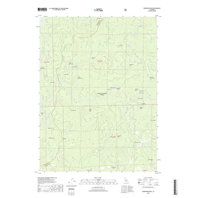
2018 Map of Damnation Peak
USGS Topo · Published 2018About this map
The Trinity Mountains dominate this 2018 survey, which straddles the high divide between Trinity and Shasta Counties. This area of the Shasta National Forest is defined by its deep drainages and named ridges, including the prominent Damnation Peak and Blue Mtn. The landscape is etched with local history found in the naming of its remote terrain, from the descriptive Horsebone Ridge and Pismire Ridge to the steep The Incline in the northeastern corner. Settlement is sparse, with Oak Bottom situated near the southern boundary along Stacey Cr. This record of the modern wilderness also highlights important water sources like Grouse Spring and Quartz Spring, alongside numerous gulches that trace the complex hydrology of the N Fork Dog Cr and Clear Cr systems.
Find a feature on this map
54 named features on this map. Tap any name to fly to it.
Don’t see what you’re looking for? This feature index may not catch every label — zoom into the map to look around manually.
Map Details
Editions of this 2018 Damnation Peak Map
This is the sole edition of this map. No revisions or reprints were ever made.
Other maps of this area

1886 · Shasta
USGS Topo · 1:250,000

1890 · Red Bluff
USGS Topo · 1:250,000

1894 · Red Bluff
USGS Topo · 1:250,000

1894 · Shasta
USGS Topo · 1:250,000

1901 · Redding
USGS Topo · 1:125,000

1913 · Weaverville
USGS Topo · 1:125,000

1923 · Sawyers Bar
USGS Topo · 1:125,000

1931 · Etna
USGS Topo · 1:96,000

1934 · Etna
USGS Topo · 1:125,000

1935 · Dunsmuir
USGS Topo · 1:125,000