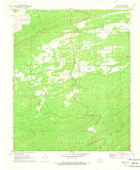
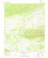
1971 Map of Damon
USGS Topo · Published 1973About this map
Damon serves as a central hub in this early 1970s topographical study of Latimer County, situated near the headwaters of North Gaines Creek. The landscape is defined by its dramatic elevation changes, bounded by the prominent ridge of Blue Mountain to the north and Eightmile Mountain to the southeast. Local community life is anchored by landmarks like Gum Creek Ch and the Damon Cem, while the Veterans Colony occupies a distinct position nestled between the drainage of South Gaines Creek and the southern slopes. The presence of a Gravel Pit near Pine Creek and various fence lines, meticulously noted from 1970 aerial photography, points to a rural economy based on land management and small-scale resource extraction. Water remains a vital feature of this terrain, from the Lloyd Church Lake in the northwest to the rugged descent of Boggs Hollow Creek in the south.
Find a feature on this map
23 named features on this map. Tap any name to fly to it.
Don’t see what you’re looking for? This feature index may not catch every label — zoom into the map to look around manually.
Map Details
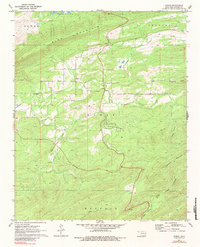
Editions of this 1971 Damon Map
2 editions found
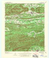
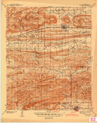
Other maps of this area

1901 · Tuskahoma
USGS Topo · 1:125,000

1908 · Tuskahoma
USGS Topo · 1:125,000

1909 · Tuskahoma
USGS Topo · 1:125,000
1940 · Red Oak
USGS Topo · 1:62,500
1943 · Red Oak
USGS Topo · 1:62,500

1950 · Mcalester
USGS Topo · 1:250,000

1962 · McAlester
USGS Topo · 1:250,000

1965 · McAlester
USGS Topo · 1:250,000
1971 · Yanush
USGS Topo · 1:24,000
1971 · Kiamichi
USGS Topo · 1:24,000